For those of us who have lived more or less within a few miles of saltwater for most of our lives, something about the dry, arid deserts and plains can be just about the most exotic and otherworldly place imaginable. Something from a movie. From a Western novel. There are (almost) no trees, no humidity, a huge sky, and an expansive horizon where it seems you can see forever.
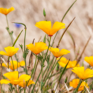
Earlier this summer I was in Sterling, Colorado and decided to make the short but desolate journey west to the Pawnee National Grasslands. I had never seen a land so barren in my life. Rolling hills that went on to the horizon in every direction, with groups of pronghorn antelope in the distance every so many miles. Sporadic patches of the land were carpeted in brightly colored wildflowers, and many of these were blooming cacti in gorgeous golden yellows and fiery oranges. I was off to see the twin geological wonders known as the Pawnee Buttes.
East Pawnee Butte
~ click to enlarge ~
Travel was easier than I thought it might be. The rough road wasn’t impossible, but I thought navigating through the actual grassland (it was mostly rocks and cacti) would be more difficult. Luckily I brought my beloved nature photography mountain bike with me. Avoiding the spikiest cacti and strapping down all my camera gear to the rack and saddlebags, I made good time crossing overland. Finally seeing the Buttes in front of me was an awe-inspiring experience. The view in front to me looked like a painting. Unreal. In no time I was set up and busy composing my shots.
The Pawnees Buttes are a perfect example of how to define the abstract notion of time. What we as people think of time is but a flash when it comes to geological time of our planet. These majestic and wondrous formations are made mostly of mud and capped by a hard layer of limestone rock. Over time immeasurable this land, which was once a shallow ocean, is eroding at the slowest pace we can imagine. These limestone caps were once at ground-level and over the eons have protected the dried mud underneath from erosion, resulting in what we see now as two nearly three hundred-foot sheer pillars. Just try and imagine how long it would take desert rain and wind erosion to drop the level of the entire landscape by three hundred feet! Mind boggling.
Sharing and commenting via the social media links below will help me greatly, and is much appreciated.
Thank you in advance!
ALL IMAGES ARE AVAILABLE FOR PRINT OR DIGITAL DOWNLOAD. JUST CLICK ON THE IMAGE AND ADD TO CART.










Very cool Rich ! The west is where i need to be. A completely different lifestyle with some of the most diverse topography and some truly magnificent scenery ! Well done my friend…
Thanks Bill! You should have been out there with me!